Monday, April 11, 2016
Today we are taking Dave and Roxy on the Apache Trail Jeep ride.
Per American Southwest.."This trail is named after the Apache Indians who once used the route, the Apache Trail, or AZ 88 as it is officially known, links Apache Junction at the edge of the Greater Phoenix area with Theodore Roosevelt Lake, through the Superstition Mountains and the Tonto National Forest;
40 miles of steep, winding and mostly unpaved road past magnificent
scenery of twisted igneous mountains with dense forests of saguaro and
ferocactus, and several deep blue lakes. Past the lakes, the original
route continues in more traditional fashion to the former copper mining
town of Globe (via Hwy 188), but it is the western half which is the
most scenic and well-known..."
Our first stop was the Superstition Mountains Museum. This little church as been used in several western movies. Now it is used for weddings.
Elvis can even serenade you! Ha Ha!
This stage coach was also used in movies. I can't imagine traveling like that. The Jeep is not rough riding at all compared to a stage coach.
Above and below are some of the views as we walked through the outdoor museum.
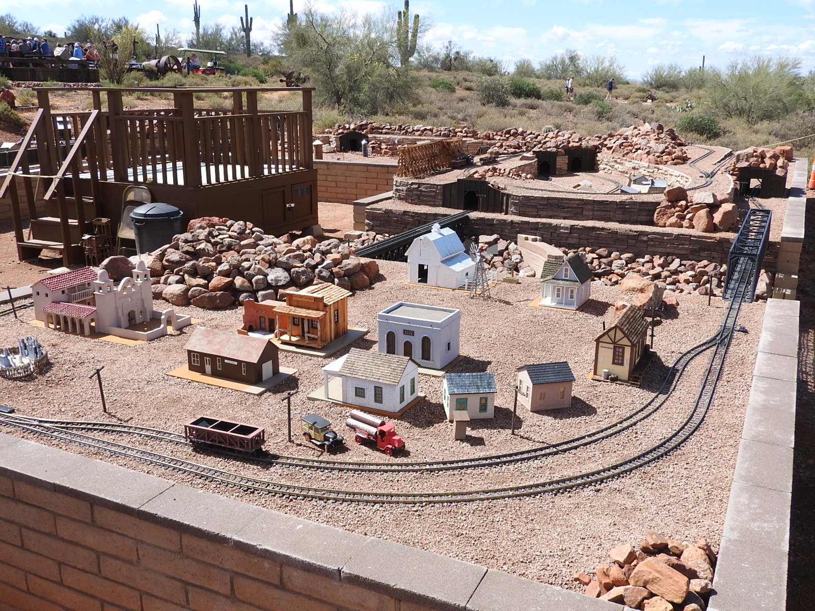
They are in the process of building a miniature railroad display of the area.
It is going to be large. The platform in the middle is where the trains are operated from. The barn in the background housed several horse drawn buggies, wagons and work implements.
The "building" behind the large saguaro is actually rock crushing equipment called a stamp mill. This stamp mill, used to extract gold and silver from ore, was built in 1914 and originally used in Bland, New Mexico. The mill was donated to the museum in 1988. We got to see a 5 of the 20 stamps operate. That is why people are standing around.
You also get a good view of Superstition Mountain.
This carved tree stump was at the gift shop area.
Time to move on down the road.
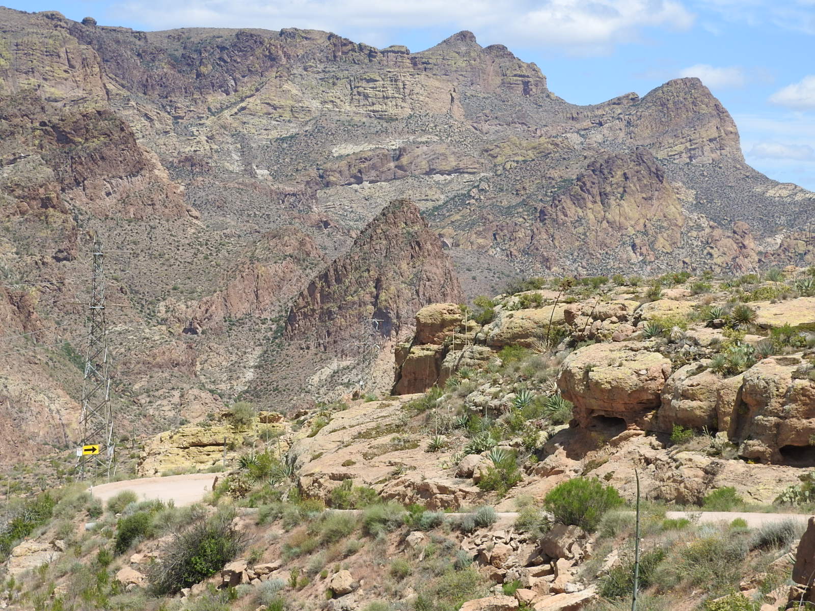
The views were gorgeous and the clouds enhanced the sky. Can you see the road curving?
The mountains are rugged! The sun was VERY bright and David blinked just as we took the picture. Oh well. Just wanted to prove they were with us. Hee Hee
We arrived at the town of Tortilla Flat just in time for lunch at the only restaurant. The walls and pillars are all covered in $1 dollar bills. Notice the stools at the bar are actual saddles.
Dave & Roxy were facing one direction. See all the dollar bills???
We are facing the opposite direction...more dollar bills!
They're everywhere; they're everywhere!
This picture and the two below are murals in the men's restroom. I promise I did not take these pictures.
The 2 pictures below this are just a couple from the ladies' restroom and I did take them.
Time to move on. We've got a long ways to go.
The clouds are beautiful over these rugged rock formations!
We crossed several one-lane bridges. Thankfully we never met anyone at any of the one-lane bridges.
The first lake we saw was Canyon Lake. This is looking from the west side to the east side of the lake.
The pictures above and below are as we got closer to Canyon Lake. There are no beaches. The canyon walls go straight into the water.
We did finally find a small rocky shore. There was a marina also, but no picture.
This is pretty rugged country. You can just notice the flowers of the ocotillo plant.
Much of the dirt road was winding and narrow in some spots.
See the winding road. We are headed there.
See the hole/missing rock in the ridge top. Sure looks like the missing piece in the circle, don't you think?
This picture is the same formation as above but not zoomed. Can you still see what we are talking about?
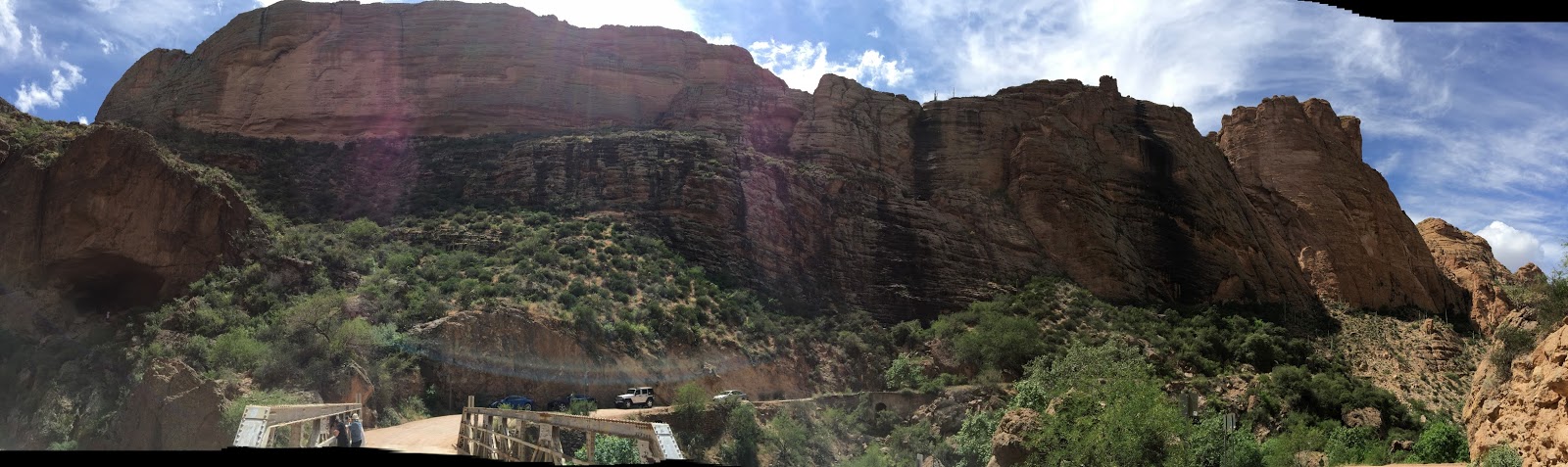
Tic took this panoramic. Can you see Dave, Roxy and Dusty? What a view!!!!
We are on the other side of the mountain range now. Headed down. We will be following the road you see below.
Here we are headed to another one-lane bridge on this narrow winding road.
I drove all day. It was a fun drive!
If you look hard you can see the one-lane bridge on this hairpin turn.
Here's another one-lane bridge. Tic took this through the windshield. There is another car coming, but we got across before it needed to cross.
The 3 pictures below are just along the drive.
This yucca had a beautiful stalk with flowers. See the 2 closeups below.
This is Apache Lake. It was getting late and we decided not to drive down to the lake. There was another marina at the lake. This drive has been so beautiful!
Aren't we cute! Great setting, if I say so myself.
We finally made it to pavement again here at the Roosevelt Dam. If you look carefully at the left shore you can see rocks under the water. It was amazing how clear the water was.
This is the Roosevelt Bridge on SR 188 at the end of SR88 (the Apache Trail) on Roosevelt Lake just east of Roosevelt Dam. We are on our way to Globe.You can see the Roosevelt Dam marked on the map below.
 We drove the complete circle. It was a long and wonderful day!


No comments:
Post a Comment