Total Pageviews

Thursday, June 28, 2018

Dirt Roads back to Buena Vista from Salida CO

Thursday, June 28, 2018

This morning I have a doctor appointment in Salida, CO with Dr. Ralph Wentz, DPM to make sure my broken foot is healing properly. He took 3 x-rays and it looks good for 3 weeks from the break.  I am to wear my boot for another 3 weeks, then my hiking boots for 2 weeks, then I'm free to go. I can walk in my boot as much as is comfortable.  I plan to start increasing that time.  Looking forward to being back to normal activity.

Since we were in Salida we decided to take back roads (some dirt and some 4X4). It was a beautiful drive.


As we were climbing in elevation not far out of Salida, we came upon this pond.  Don't know if it has a name. This area is very arid so it does not seem likely it is where rain has gathered. Perhaps there is a spring? Not sure.


 The map tells us we go up to 10,600'. This was a quick view between the trees before we reached the top.


This is the good part of the road before we got to the 4X4 Jeeping part. The Jeeping part was very rocky so slow going.


 The top of the road takes us to Aspen Ridge.  All the lighter green trees are aspen.


 We drove a good distance through thick aspen groves like this one.


More beautiful mountain views.  Looks like a painting.

There were bunches of these beautiful blue and white columbines all around. The sun kind of washes out the color.


 We just couldn't get over the awesome views of the mountains from up on Aspen Ridge.


I believe these are lupine flowers.  The sun is so bright it is washing out the beautiful blue.  They were all over also.
One last beautiful view as we start to descend off Aspen Ridge.  WOW!  We had another awesome drive today.


Loop Drive from Buena Vista to Breckenridge and back

Wednesday, June 27, 2018

Again since Dusty can't do any hiking we planned a loop drive from Buena Vista to Fairplay to Breckenridge to Frisco to Silverthorne to Copper Mountain to Leadville and back to Buena Vista.  It was such a beautiful day that we took the T-top off the Jeep.  


 This neat old building was sitting by itself in the middle of a large block as we drove thru Fairplay. There weren't any signs that we saw that told us what it was.  Like the building anyway!

Before we got to Breckenridge we crossed the Continental Divide at Hoosier Pass. As you can see we are at 11,539'.


 Our view as we are coming down the other side of the continental divide.


Shortly before we reached Breckenridge we saw this pretty little lake called Goose Pasture Tarn. It looks so serene here in the high mountains.

 Above and below are as we are coming into Breckenridge. You can see the many ski trails. The gondolas were running to the top but the line was much too long. 


As we were leaving Frisco headed to Silverthorne we saw this huge lake named Lake Dillon. The next 4 pictures are of the lake from a scenic viewpoint.


 More gorgeous mountain views from I-70 as we exit South of Copper Mountain on CO-91.


 Above is the Clinton Gulch Dam Reservoir. We stopped here to have our picnic lunch.


This is the dam and the mountains looking the opposite direction from above.

There was even a nice flat boulder I could sit on and prop my leg up. WOW what a blessing to be able to enjoy lunch here.
Below is the same reservoir from the other side from our lunch spot. 

 As we are headed to Leadville, we can see lots of mining still going on.  Look how the countryside has been affected. Sort of sad.


 Above and below you can see snow still on top of many of the mountains. However, we've been told the snow would normally be at least 4 times this.  The snowfall this last winter in this area was extremely smaller than usual.

We stopped along the Arkansas River in the Numbers area and got this picture.  The Arkansas River is gorgeous here!

We feel so blessed to be able to see so much of God's glorious wonders!

Tuesday, June 26, 2018

Sights between Buena Vista and St Elmo, CO

Monday, June 25, 2018

Our adventure today is driving to the being-revived ghost town of St Elmo. This post is a little longer because of so many beautiful sights and interesting things to see.


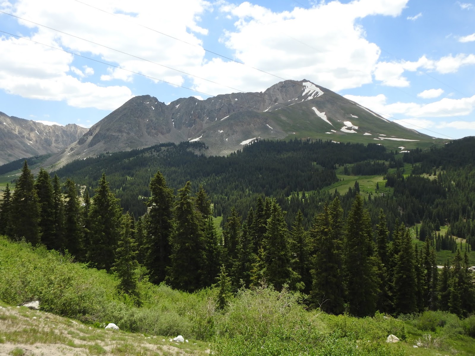
Above and below are peaks in the Sawatch Range that defines the Continental Divide. Fifteen of the peaks in the upper Arkansas River Valley are "fourteens" boasting summits reaching over 14,000 ft. This valley was initially developed to meet the needs of area miners. Cattle ranching and farming was started in 1863.


 Above is Mt Princeton Hot Springs & Spa Resort. It is best in the winter when all the pools are open.  Below is a public pool just across the street from the resort. This was our view as we came down into the area.


 Above and below you can see avalanche areas.

We are taking CO County 162 to St Elmo. The road follows Chalk Creek.


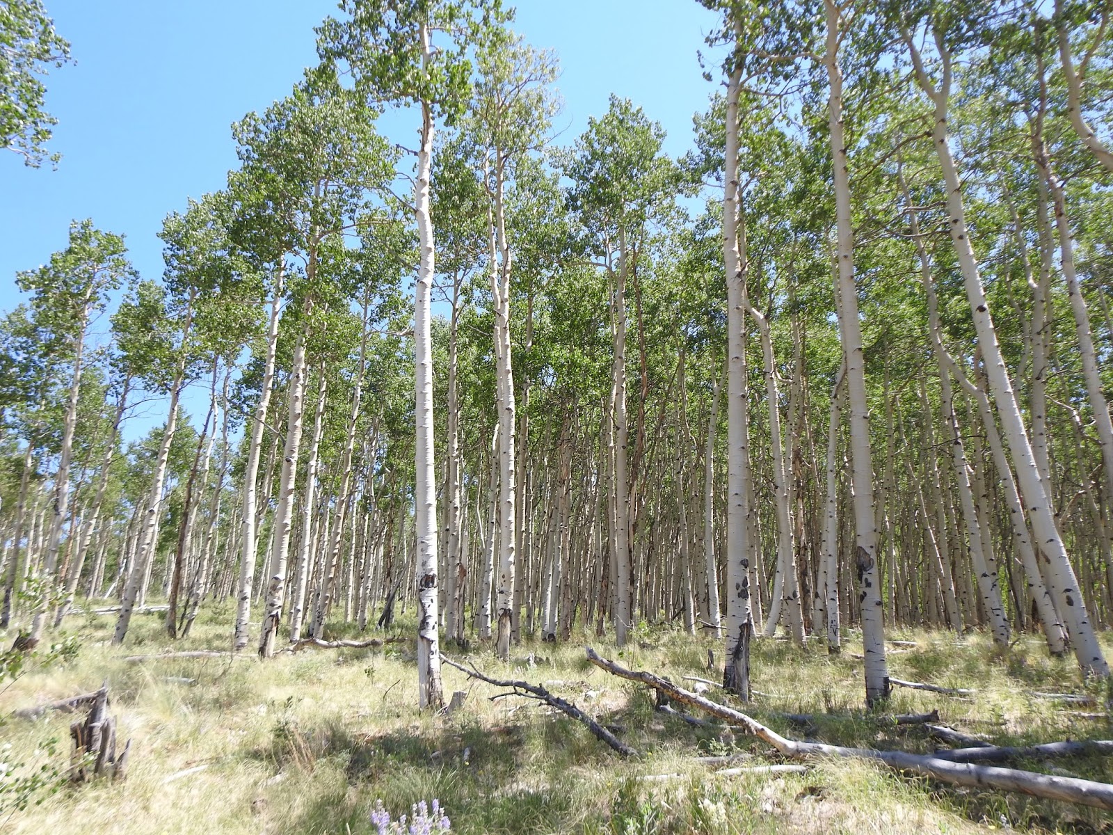
We have arrived in St Elmo.  While the town is technically a ghost town, it does have a small population. There is a general store and you can stay the night in an authentic cabin for $79/night or less than $500/week. The next 12 pictures are of the town.  Some are being lived in, while others are being restored and still others just left as is.


The town has a truly amazing setting!

 This is one end of Tincup Pass that goes between St Elmo and Tincup.  This moderate-rated pass is at an elevation of 12,154 ft and is the highest pass in Colorado. Snow is frequently present until early July. After reviewing the drive, there are places where Tic felt we might need a spotter to direct the driver. Since I can't drive, we decided not to drive this route. My broken foot has stopped many activities for us.
Bummer!

We did take a Jeep road back for a little ways. It was interesting and beautiful.
This is the newly restored entrance to Iron City Cemetery. Reviews say there is a lot of history on the headstones. If I could walk, I would have wandered thru the cemetery.

More neat views along the Jeep road.

 As we got towards the small township of Alpine, we saw Alpine lake. Unfortunately the lake is private.


 Tic even got pictures of wild roses growing along side the creek for me.


The mountains along here a rugged to say the least.

We came along a pullout with a sign Cascade Falls. This is still on Chalk Creek. The following 5 pictures are different views of Cascade Falls Tic took.


Just after we left the falls there was a small area to watch wildlife.  
Our timing was great as this small herd of mountain goats (sheep) crossed the road in front of us. It took me a minute to get the camera out and ready so all I got was their butts. Ha Ha


 Above and below are sections of the Chalk Cliffs in this area.

The last thing on our way home was this little schoolhouse. It is Maxwell Park School formerly Mt Princeton School. It was used from 1889 to 1933. Restoration began in 1989. It was not open for viewing.

WOW another day filled with so much of God's glorious wonders!