Alpine Loop starting and ending in Lake City, CO
Sunday, July 8, 2018
Today we are going to explore the Alpine Loop which connects Lake City, Silverton and Ouray. The roads to Silverton and Ouray branch off the loop. We do not plan to go to Silverton or Ouray. The loop itself is said to be 65 miles and it took us all day. Due to the abundance of splendor the post has more pictures than most.
We drove the fast way to Lake City and plan to end the loop back in Lake City .
As we headed out of Lake City we drove along side the San Christobal Lake.
There was only a slight breeze so Tic got this reflection picture of the lake.
Then we saw this suspension walking bridge and thought that was neat. We wanted to walk across it, but there was a gate that prevented that. Oh well.
The road turned to gravel. We thought if the road stayed this way it would be an easy day.
These are some of the views as we headed up to Cinnamon Pass.
More splendor as we are still heading to Cinnamon Pass.
Above is the road we drove up to Cinnamon Pass.
Above is another view from Cinnamon Pass. Below is the view of the direction we will be heading down Cinnamon Pass. It's hard to tell that the top of the mountain pictured below was cinnamon colored and thus the name for the pass.
As we headed down the other side of Cinnamon Pass the views were just as splendid!
At this point we are looking down on Animas Forks, an abandoned mining town. It was developed in 1873 at 11,200' elevation. By 1876 there was a sizable hotel, a general store, saloon, post office and 30 cabins. By 1904 the Gold Prince Mill was built and the Silverton Northern Railroad came into Animas Forks. Below is looking towards Silverton CO from the same point.
The next 5 pictures are of the ghost town Animas Forks.
This is a pretty fancy house for that era.
Now we are headed out of Animas Forks towards Engineer Pass. By the way, the road is extremely rocky and slow going and has been for a good ways.
As we rounded a curve the land opened up again and we saw a huge herd of sheep. This is only a small portion of the sheep.
More glorious views on the way to Engineer Pass. Below shows the road we had taken to reach this high point.
Most of the drive from Animas Forks was around 12,000' elevation.
The road doesn't look as rough as it actually was. We are still headed up to Engineer Pass.
According to our phone app we are right at 13,000' elevation. WOW!!! The picture below shows what we thought was going to be our route up that mountain side. SCARY!
Here we are at the spot marked the summit of Engineer Pass. The above picture looks towards the North.
We actually came downhill slightly to reach the pass sign. Below is the road we will take down from here. I was glad we did not go up the side of the mountain pictured above!
As we headed downhill there were many more spectacular views.
We came upon this house. The parking was at the road then you had to walk across a suspension bridge to reach the house. We actually saw a man with his young child out on the porch. Wild and crazy but stupendous views!
Dusty's wildflower picture.
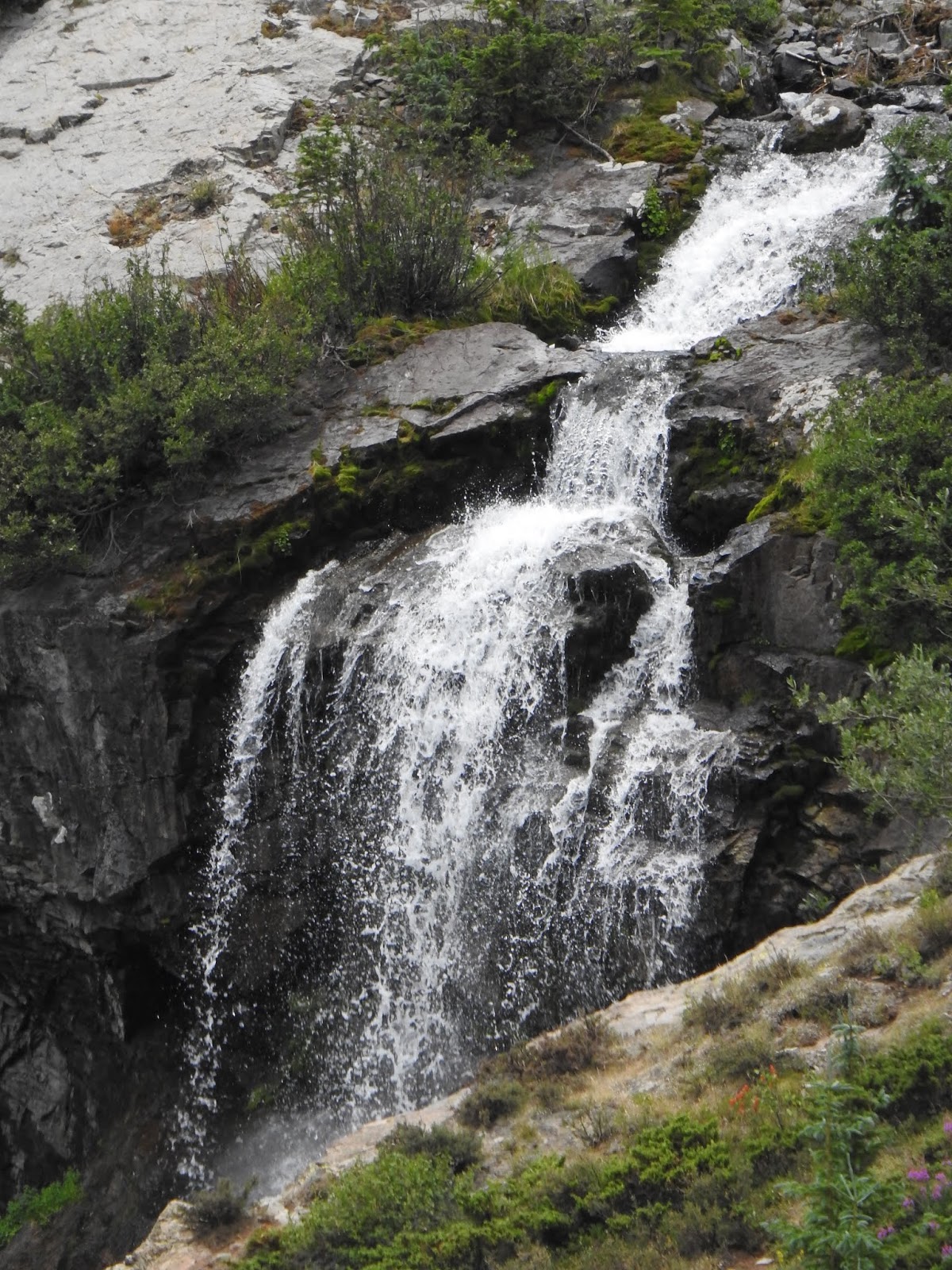
I believe we are following along the Henson River. Above is a closeup of the waterfall in the picture below.
This is another waterfall named Whitmore Falls. It was not a long walk, but there were lots of stairs and I don't do well with stairs since I'm in my boot. Tic walked down and got some pictures. This is the best one of Whitmore Falls.
As we got closer back towards Lake City, we saw this large corral. Another beautiful setting!
It has been another wonderfully blessed day!!!


No comments:
Post a Comment