Chiricahua National Monument
Thursday, December 4
We planned to leave right after breakfast to go to the Chiricahua National Monutment, however it was raining this morning. They said on the TV weather that it was supposed to clear up around noon. We decided to do laundry and go grocery shopping this morning and leave after lunch. After lunch it was still raining, but we decided to go anyway with the hopes that it would clear up as we drove south.
This was the view on the way down. We were hoping by the time we got to Chiricahua that it would be clear.
It was about 2pm when we arrived. It was still overcast and had rained on us part of the way down.
This was an interesting cave we saw as we were driving in.
The farther in the park we got the foggier it got. Because of the fog we came back a few days later when the sun was out.
The red line is the driving road up to Massai Point. We hoped we would be able to see something at least, so off we went.
Even though it was foggy, we got some pretty pictures. The rock formations throughout this park were amazing.
Here is the same picture taken on the sunny day we went back.
As you can see the higher we got the foggier it got.
Here is a sunny day view. Isn't it awesome.
This formation was named the Sea Captain. Because of the fog, you can see the eye easily.
Here is the Sea Captain on a sunny day. If the picture was not a close-up, the eye would not have been as easy to see. Tic had to take a couple of pictures from different angles to get a view of the eye.
These columns are majestic. Look at the one that appears to not have any support.
This is looking up at the column that appears to not have any support.
Tic took a lot of pictures of all the magnificent formations. It was hard to pick out just a few pictures.
This is a description of how these rocks were formed. It got so foggy that we could not see anything by the time we got to the top.
Look a the beautiful clouds we saw on the way home.
This is the road back to town with more clouds.
On the way back the clouds began to break up and we saw the moon.
We enjoyed what we could see
so much that we decided we needed to go back. So on Sunday, December 7
we went back. The rest of the pictures are from the sunny day.
We could see more neat formations on the way to the top this day.
This is the road up to Sugarloaf Lookout.
This is a view of a couple of mountain ranges you can see from the top at Sugarloaf Outlook.
The trail climbs 470 ft to the Sugarloaf Mountain Peak from the parking lot. At the top is an outlook station for fire.
This is the outlook station on Sugarloaf. We did not take the hike.
This is looking out one side of the parking area at Sugarloaf.
And this is looking out the other side of the parking area at Sugarloaf. Next we drove to Massai Point.
Here is a little info about Massai Point.
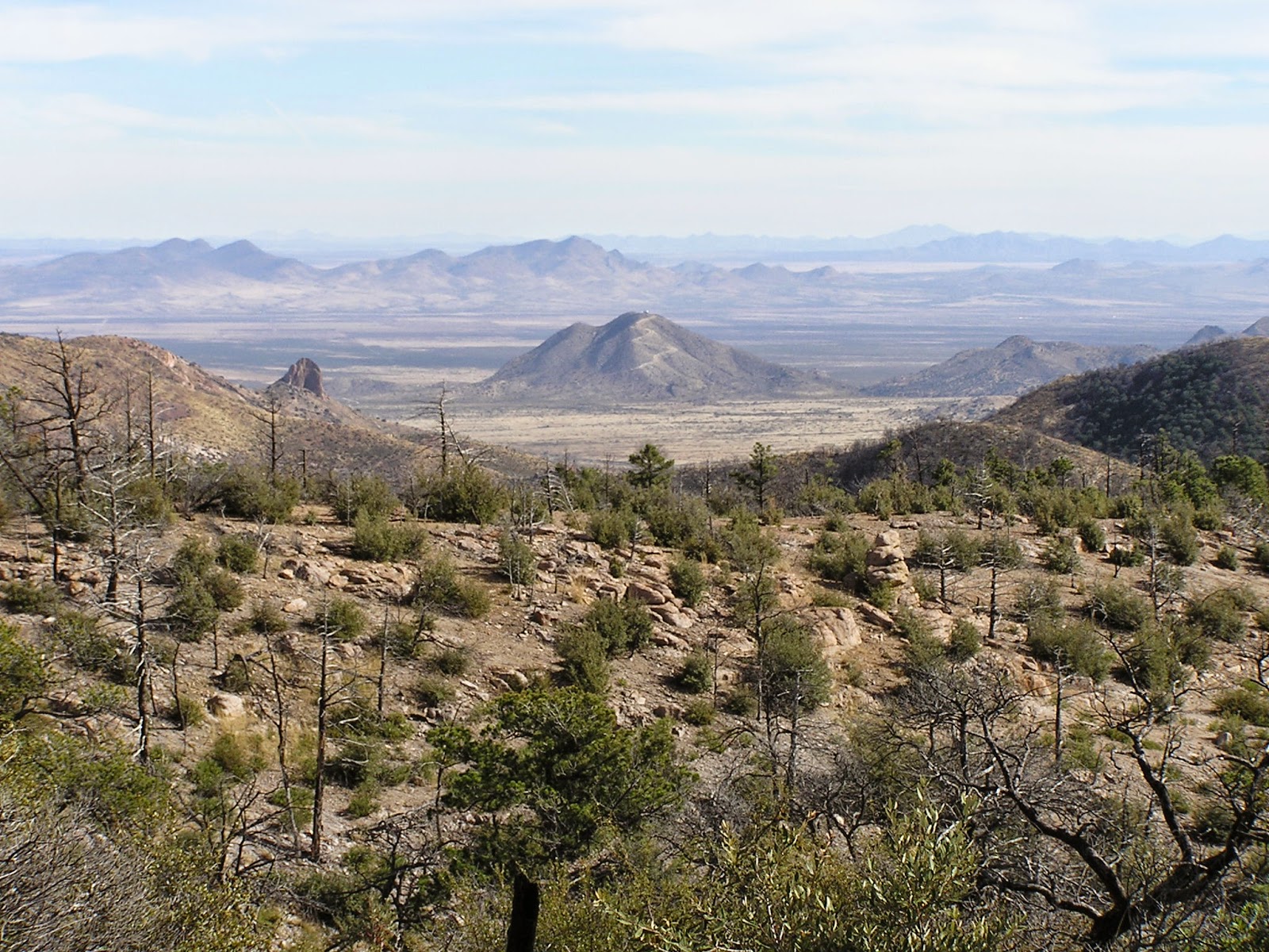
This is a view from Massai Point in one directions in which you can see a couple of mountain ranges.
But look at this!!! This is another direction from Massai Point where you can see maybe 5 mountain ranges and a bunch of interesting formations!
This is a really cool lookout point that you can take a short hike to. We went and looked out from there.
Looking out over this looks like a huge village of small buildings. What do you think?
To me this looks like a fist holding something between the thumb and fingers.
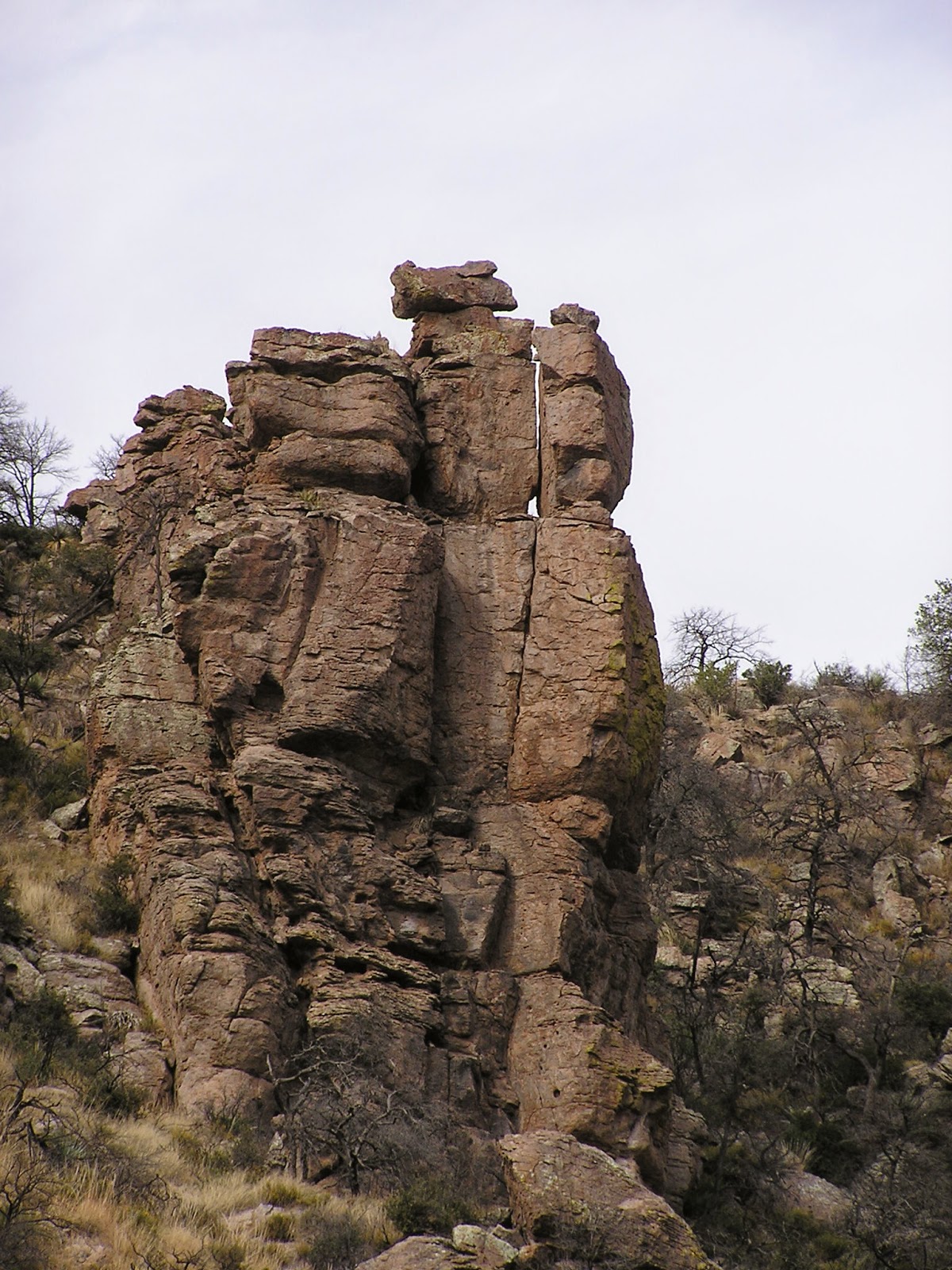
These are two formations close to the lookout.
The size and angle of these. It is amazing to us.
Another short walk from the parking area was a nature center full of informational signs.
This is a good description of the view I showed earlier.
There was a huge volcanic blast that formed the rocks here.
This information sign talks about Harris Mountain. The picture below is how we actually saw Harris Mountain.
This looks a lot like the picture on the info sign. Doesn't it? See the road that goes to the top of Harris Mountain?
As we were driving back down from the top, we decided to stop at the Natural Bridge Trail. It says it is 2.4 miles one way to the Natural Bridge.
Dusty stopped to look at rock formations. Tic liked the tree so got the tree and me.
Here are some formations we got up and close to on the way to the Natural Bridge.
Here are more great formations on our walk. It seemed a long way.
After we got out of the valley between the rocks, we started climbing up a hill. Can you find the trail below as we look back? It is lined with rocks. We are in the middle of no where.
We saw this cave with grass growing at the mouth. We did not climb up or down to it, but it does look interesting.
We kept going up and going up. See the trail below? After hiking about 1.5 hours we still had not come to the Natural Bridge. By this time it was just after 3pm. We were concerned it would get dark before we got back if we did not turn around now. Not sure how much farther it was before we reached the Natural Bridge. We gave up and headed back to the Jeep.
Here's Dusty heading back. As you can see we are really far out from the parking spot.
We got back to the Jeep much quicker.
As we got back to the Visitor's Center at the entrance to the park, we saw this beautiful blue bird.
Unfortunately the picture is out of focus, but you can still see the beautiful blue color of this bird.
We headed out of the park for our next adventure.


No comments:
Post a Comment