Grapevine Canyon Petroglyphs in Christmas Tree Pass
Sunday & Monday, January 25 & 26, 2015
Sunday we left Las Vegas and headed back to Bullhead City, AZ. We arrived in Bullhead City about 1pm. We got parked and settled.
This is our parking spot this time. The spot is not as level as last time.
We needed several things from the store so we went........
This is one of the casinos across the river in Laughlin, NV. It is actually a building made to look like a paddle wheel boat. Good job, huh! On to Walmart.
Tic went to the edge of the RV park after dark and got some pictures of the casinos on the other side of the river.
Above and below are some closeups of the a few of the casinos.
Monday we decided to take a short drive and hike to Christmas Tree Pass just outside Laughlin, NV to see petroglyphs we were told about.
As we turned off the highway onto the road to Christmas Tree Pass we saw this mountain. We thought it was interesting to see whitish rocks protruding in just a few places.
This is a closeup of the rocks on the right side of the picture prior. Below is a closeup of the other two peaks.
The protruding rock formation is of a very different type of rock than the rest of the mountain.
We were told to turn when we saw the sign for Grapevine Canyon. The Grapevine Canyon Petroglyphs are located in Grapevine Canyon on Spirit Mountain near Laughlin, Nevada.
The area is also known as Christmas Tree Pass.
While the petroglyphs extend through the canyon, a significant
concentration lies at the entrance to the canyon which is at an
elevation of 2,395 feet. The area features over 700 petroglyphs and many rock shelters.
We parked and took off. At the start of the hike was this sign.
Tic was intrigued with the color variations in this rock. It was about 18" on each side.
There were several unique rock formations along the walk beside the dry riverbed before we got to the petroglyphs. The picture above and the next several are of the walk to the petroglyphs.
The 3 rock formations above were just before the following picture.
This hillside was some rocks but mostly sand and gravel.
This is closer to rocks along the side of the dry riverbed. You can see Dusty walking.
At this point we had to head down into the riverbed.
This show the riverbed we are headed to.
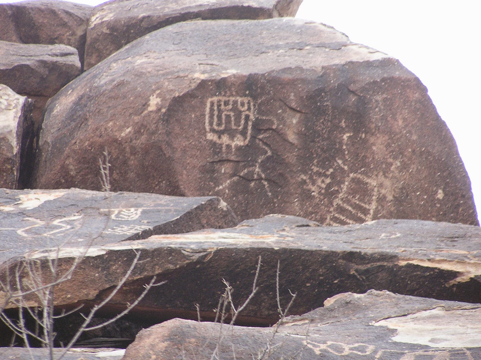
As soon as we got into the riverbed and turned the corner, WHAM there were petroglyphs everywhere. The rest of the pictures I put below are all of the petroglyphs we took pictures of. Most probably won't have comments.
You can see this rock in the prior photo. Dusty climbed up to get a closer look.
This is the last picture we took. It is the actual rock that was in the picture at the beginning of the trail. Per Wikipedia, the glyphs were created between 1100 and 1900 AD. Both the meaning of the glyphs and their creators remains unclear although the area was inhabited by the Mojave.


No comments:
Post a Comment