Prescott Valley, Prescott and Jerome, AZ
Tuesday, May 3, 2016
The weather has cleared and we are off on a big loop drive through Prescott Valley to Prescott and on to Jerome. From there we'll go on to Clarkdale, Cottonwood then back to Camp Verde.
From Prescott, we went down to Wilhoit then through Skull Valley and back to Prescott. We were told this was a beautiful drive.
This was our view as we came through a pass and down into Prescott Valley. WOW the houses are spread out all over the place.
Tic took this as we got a little further down the hill looking away from Prescott Valley.
Unfortunately this picture does not show the colors of the mountains. We had a awesome views.
As we were leaving Prescott we saw this interesting peak on the Circle M ranch. Unfortunately it was not public land so we could not drive up it.
Out of no where, the rocks were white and uniquely shaped. See above and below. We were driving through Skull Valley at this time.
Nearly all of these pics were taken out the window as we drove along. Tic was about beside himself when I would not stop to let him out to take pictures, but the road was narrow and had little or no shoulder. And I would have to sort thru 100+ photos.
We are on our way back to Prescott after going through Skull Valley.
We are almost back to Prescott. Many of our pictures just don't show the majesty of our views.
Once we were back to Prescott, Dusty had to make a rest stop so we stopped at the library.
Tic took a walk and found this statue on Main Street just a block from the library.
More interesting rock formations just outside Prescott on our way to Jerome.
One of the stickers on the van said, "This is not a slow car, it is a fast house." Yikes, NOT MY house. You'd think we were in California the land of fruits and nuts! Hee Hee
The road to Jerome from Prescott is very windy, and you are required to drive slow. This short clip will give you an idea of what the route is like.
The road is in good shape, but nothing over 50' in length allowed because of the sharp turns. Imagine meeting a large vehicle on this road.
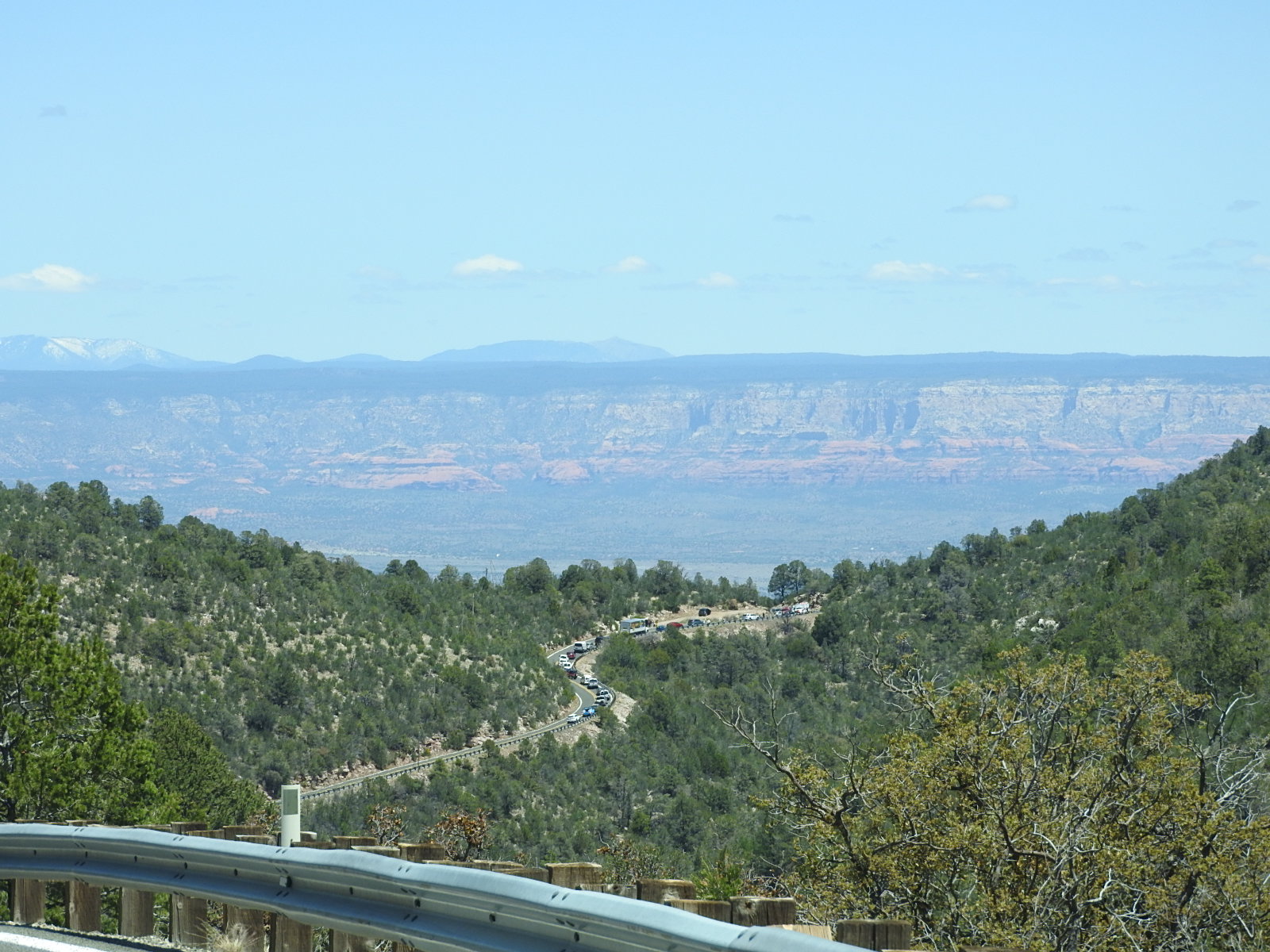
Looking ahead, we can see that traffic is stopped, and we could just make out flashing red lights. Uh oh!
Two cars approaching each other and at least one was over the center-line. Evidently, it popped the airbags on both vehicles, but no one was seriously injured. Good thing too, because we are quite remote from medical facilities at the moment. They would probably have required an emergency airlift.
Now we are headed down the mountain from Jerome to Clarkdale. We did not tour Jerome this trip as we spent a day here last year taking pics and hopping in and out of some shops. The streets were absolutely packed with tourists.
This is a pullout (scenic overlook) and if you judge by the size of the roadway and the vehicles on it, you can get an idea of how massive is the terrain.
And over the edge and many feet below is the town of Clarkdale.
Massive, rugged, gorgeous!
And in the distance, we can see the The San Francisco Peaks, a volcanic mountain range located in north central Arizona, just north of Flagstaff and a remnant of the former San Francisco Mountain. The highest summit in the range, Humphreys Peak,
is the highest point in the state of Arizona at 12,633 feet (3,851 m)
in elevation. The San Francisco Peaks are the remains of an eroded stratovolcano.
If you are ever in this area, I think you would enjoy this one-day excursion. And if you plan on touring Jerome, which by the way is well worth it, plan to arrive early or you may not find a place to park.


No comments:
Post a Comment