Isleton, CA - Brannan Island
Thursday, May 14, 2015
Today we moved from Coarsegold to Isleton, CA. It was about 160 miles.
We crossed this draw bridge on Hwy 12, to the island where our RV Resort is.
In California the speed limit for anyone towing is 55 mph. That speed limit makes our travels longer than we usually travel in a day. No matter, we arrived at our new location of Delta Shores Resort & Marina about 12:30 pm.
Here we are parked at our site. The interior roads are gravel. The sites have partial gravel pads. Looks like the grass and weeds have taken over part of the parking pads. We do have 50amps with full hook ups. Not much space to park our Jeep.
The park advertises a marina. It is across the street.
This is the marina dock on one side of the walkway and the other side looks just the same.
Tic is standing at one end of the marina docks and I am at the other end. You can barely see my blue jeans at the other end.
This is the walkway down to the marina docks. See the birds flying under the dock? When someone walks on the dock, the birds go flying.
This a blowup of one of the birds flying around. They were really fast, so Tic did good to get this.
This one landed on a pipe close to the dock so Tic could get this closeup. Notice his legs are different colors. Interesting.
Tic started to whistle and the bird cocked its head. Cute!
We are actually on a small island. We decided to drive around the edge of the island. The area here is called the Delta. There is a tall levee around the whole island. Crops of various kinds are grown on the interior of the island inside the levee.
Down the road from our RV Resort there was another marina with a restaurant. We decided to drive in just to see.
This panoramic is from the dock on the back side of the restaurant.
This is the restaurant from the same view point that the panoramic picture was taken from.
This marina is full of big boats.
This pretty spot is looking out at the Mokelumne River that dumps into the San Joaquin River which dumps into the Sacramento River which dumps into the San Francisco Bay. Notice the mountains in the distance and see below.
Tic was able to zoom in. This is Mount Diablo in the distance.
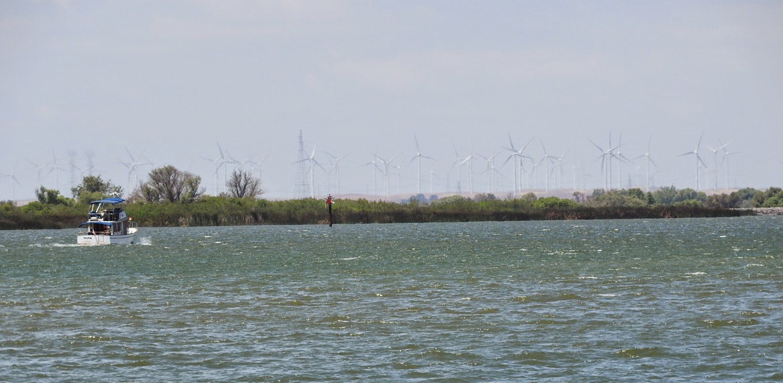
A little closer, but still in the distance was a wind farm. Great place to take advantage of the winds.
On around the island, we saw this house built 3 stories up. We wondered is you get up by elevator or stairs. The garage looks plenty tall for a motor coach. Just saying....
This place had a "For Sale" sign at the levee level street. By looking at the house from this side and the other side as seen below, we believe this could be a duplex. We wonder if both sides as for sale or only one side.
This house is actually inside the levee. You can see a little of the farm lands in the picture. Looks like straight across the street is being cultivated at this time.
Here is a pretty marina that had flowers on the road side and a thick growth of some water plant in the water.
There was much more of the same so that is the end of the pictures for this post.


No comments:
Post a Comment