Devils Garden and Arches
Wednesday, September 16, 2015
Today is Tic's birthday and he wanted to take the 7.2 mile hike thru the Devil's Garden at the Arches NP, so he did, he took all the pictures, while Dusty kept vigil at the trailhead waiting for his return. Therefore, Tic gets to write this blog.
The forecast was for cooler temperatures, wind and possible showers in the afternoon, so we were up early, picnic lunch packed and we were off headed directly to the Devil's Garden without any stops along the way.
By the time we arrived, got a great parking spot, Dusty decided she would do two things, she would relinquish her pedometer, so we would both have some idea of the distance Tic would travel, and she decided she would walk the path until it was at the start of the primitive loop trail. Then she would return and wait at the trailhead.
We are headed to two optional arches, the Tunnel Arch and the Pine Tree Arch. If you look close, you get a preview of the Pine Tree Arch.
There are two arches here. Not sure which one is Tunnel Arch, but suppose it is the larger of the two. Close-ups follow.
Smaller arch or tunnel?
Or is this the Tunnel Arch? I think I vote for this one.
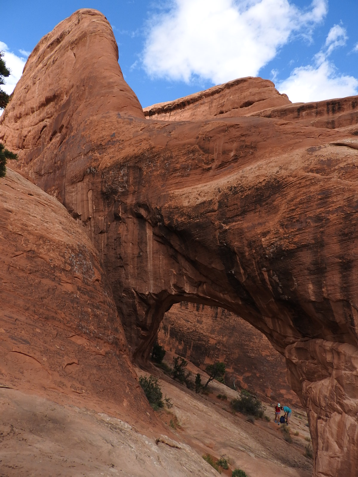
A short walk later, we come to the Pine Tree Arch. We have no idea why it has that name.
This is the Pine Tree Arch from the opposite side. It's a bit harder to see because you are looking at a rock wall thru the opening.
We are now walking to the next arch, called Landscape Arch, the longest span arch in the park.
It is difficult to tell in a photo, just how large this span actually is, but the literature says it longer than a football field.
Just to the right of the Landscape Arch are these two arches. The only name provided was the Partition Arch, perhaps because it will one day be a single arch? I did not realize it, but I would see them again, later on my hike.
One last look at the Landscape Arch, and Dusty And Tic part ways, Dusty returning to the Jeep in the parking lot, and Tic heading up the primitive trail.
Double O, OK, I'm off!
I wonder what primitive trail means?
Did not take long to find out!
The primitive trail meant walking up the "slickrock" and was a fairly steep climb. Of course, you can see that I am standing on one of the "fins". I am about half way up the climb at this point.
The trail here was very well marked, and of course, I need to see it all. So first I will view Navajo Arch then I'll do the Partition Arch.
Navajo Arch. Hmmmm. Trees block the view so I can see it is an arch, but I'm not as impressed. I will have to investigate why it is special.
This was cool. You are looking at a wall adjacent to the Navajo Arch. The ridges you see are hard. Interesting how erosion has manifested itself.
Remember the two smaller arches that were visible from the Landscape Arch? Now you see them up close from the back side.
Makes my knees turn to rubber. This is as close as I get.
I'm back to the main trail and headed for the Double O Arch. What incredible views.
I did not know until I got home, that these rock formations are called fins. I did not know at the time I took this, that I was going to get to cross over them.
Primitive trail also means crossing over a fin with the wind blowing at a right angle ninety to nothing. I should have taken a pic before crossing, but I could not believe I was about to cross this thing. It was a long way down on one side and only twenty or thirty feet on the other side.
In this photo, I have successfully crossed and looking back at others in transit. People were traveling both directions. Did I state that I suffer from vertigo? Ah well, firm ground and I'm still on my way to Double O Arch.
The Double O Arch, one over the other.
I included a second image, there is a person standing in the lower O, and helps to give perspective on the size of the two arches.
So I am now headed to the Dark Angel. It was at this point I looked at the map and saw this was not another arch, but I am committed to this hike and by golly, I'm going there. I looked back at where I had come from and saw the backside of the Double O.
This is the Dark Angel. With all the fractures at the base, it may not be standing too long. An earth tremor here would change many of these displays.
Time to cut a trail. Dusty is going to wonder where I've been.
Let's see, if I go back the way I came, I have to cross that fin again. And, I would also miss another arch. Primitive trail it is.
There is an arch that is unnamed.
Allow me to point out that little stack of rocks. It is called a cairn, and is how the primitive trail is marked. The next marker is at the end of this fin. Without these, I would still be wandering inside the park.
Trail to the Private Arch
All I can say is WOW!
The Private Arch, the last arch on the primitive trail. Time to find my way out. Where is Bear Grylls when you need him?
Back to the main "Primitive Trail"
Hmmm, which way to go? Look for the rock pile!
Oh, there they are, see them?
This is looking back at where I came from. Do you see the tree parts leaning against the rock? The longest one was at least 15 feet long. I came down across that pile. Primitive!
I came down the wall on the left, following the markers.
You cannot see the markers on the top of the fin that is by the tree, but again,that was the primitive trail.
I have been down in the canyons between the fins, and following the trail markers, find my self climbing out of a wash. The trail is directly ahead.
I'm leaving the fins behind. I brought a walkie-talkie with me and have just called to Dusty. She is waiting along the trail, just ahead. What a fun hike!


No comments:
Post a Comment