Island in the Sky - Canyonlands National Park - Part 2
Thursday, September 17, 2015 - continued
The Canyonlands National Park is divided into four parts, Island in the Sky, Needles, The Maze, and the Rivers. Access is different for each part of the park. We chose to take a back entrance into the Island in the Sky, which would start out along the Colorado River and include a Jeep trail into the park.
The last post was intended to show you the road we traveled. This post will be a restart of the same day to show the views.
Leaving Moab on highway 279, headed to Potash has us driving along with the Colorado river on one side and massive slickstone walls on the other side.
Up ahead we see cars parked and wonder what's going on.
There is a rock climber. Wonder if he has health insurance? See the tiny dot about 1/3rd the way up the rock?
We are to late, looks like he is coming back down.
He was pretty high though.
The river is actually flowing pretty fast, just deep enough, and without the benefit of rocks to make rapids, it does not show how fast it is moving.
We saw a pullout and parking for Bowtie Arch. We chose to go on without stopping, other than for a kodak moment.
Wow, look at what erosion can do without vegetation to hold the soil in place. OK, just kidding!
Same view, just not zoomed in.
And the river rolls on.
This is in the Potash area. I don't know how well this will show, but there are white strips within the rocks here. It makes them very colorful.
Now we are in an area which mines salt. We saw many man-made strip pools. We surmise that this may be part of the salt mining process.
More rocks, ....
OK geologists, explain this structure. Wind, rain, glaciers, volcanoes, and earthquakes, OR, wind, rain, glaciers, volcanoes and earthquakes?
Layers and layers of silt? It is hard to the touch, but looks like it would easily crumble.
Main road goes to the right, but straight ahead are great views of the Colorado River from the cliffs.
Colorado River view.
Parking lot.
Dusty threatened to take the camera battery so Tic wouldn't be able to take too many shots, but today it was all Dusty and she didn't stop clicking until the count reached 140.
Last view of the Colorado river, for a while.
Which ancient culture created these?
Looks like the road ahead goes into a huge canyon.
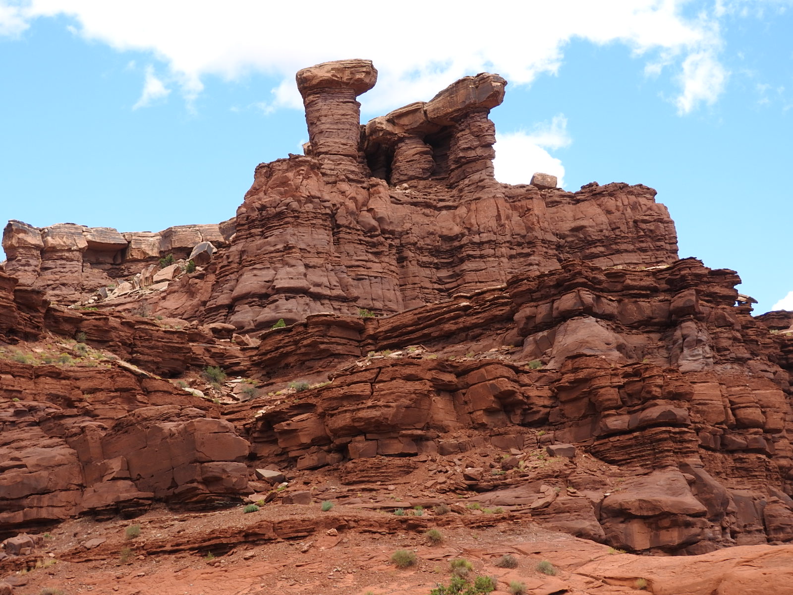
We used to have columns like these on our front porch.
From our prior post, you can see that we have reached the top of the cliff from the canyon valley below. This is where the last post ended, but we have more to see, now that we are in the Canyonlands National Park.
The views here were spectacular, but we have learned that a camera will not capture the majesty or grandeur, and it would take a camera far better than ours to capture the true colors of the landscape.
This is Whale Rock. You can see several pickup trucks parked nearby.
This photo and the next two were taken at Grand View Point Overlook.
Look how smooth the rock appears. Clean fracture.
We thought these looked like teapots.
What can I say? Humbling!
This was called the Candlestick. Clouds have it in shadow here, but I liked the way it appeared against the background.
Next, we begged our way into the Dead Horse State Park.
The fee to enter was $10.00, it was late in the day and we had no idea if it would be worth the fee, but the lady was gracious and let us enter without paying. We stopped long enough to take the following video.
By the way, if you were to spend time here, it is worth the entry fee. We may go back if we have more time to stay.


No comments:
Post a Comment