Wednesday, June 7, 2017
Today we are exploring Jasper a little. We have been pushing hard and need an easy day today since tomorrow will be a long driving day.
Above is what we see as we drive out of the campground. From this spot we can see the lookout/restaurant/gift shop at the top of the Sky Tram on Whistler Mt. Below Tic zoomed in on the lookout/restaurant/gift. Tic is an excellent picture taker.
From in Jasper looking at Whistler Mt, see the "blob" at the top of one of the peaks. That is the top of the Sky Tram. We went into town for a quick errand. On the way to town we drove by the Athabasca River.
Next we decided to ride the Sky Tram. The rides starts at an elevation of 4127 ft and the top is at 7424 ft. The ride up only takes 7.5 minutes. WOW! This is looking up from the bottom. We were told a German company built the Sky Tram in only 9 months! Can you imagine the planning?
This shows the workings of the lift mechanism,
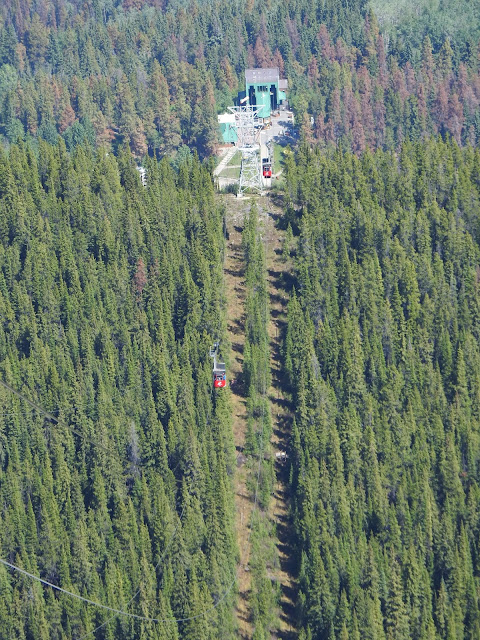
We are on our way up. Another car is on its way down. They only run 2 cars.
This is Pyramid Peak one of the more well known in the area.
At the top, we are above the tree line. There is no sign of life other than the humans running around.
We rode up about noon and it was about 72 degrees F at the bottom. As you can see it was about 48 degrees F at the top.
Us at the top of the Sky Tram. See Jasper in the background? You can also see Pyramid Peak.
The trail you see is a 45 minute hike one way to the summit. The change in elevation is 600 feet. We did not do the hike.
This is Mt Robson. It is the most prominent mountain in North America's Rocky Mountain range; it is also the highest point in the Canadian Rockies. It is also a long way off, and can only be seen on clear days.
From the observation deck we are looking down at the town of Jasper and the Athabasca River that runs through town. "The Athabasca River is the longest river in Alberta (956 miles). The first 104 miles (located in Jasper National Park) are designated as a Canadian Heritage River. As a tributary to the Mackenzie River, water flowing on the Athabasca River eventually drains into the Arctic Ocean." per wikipedia.
This is zoomed in on one of the emerald colored lakes shown in the picture above this one. The local golf resort is here.
After the tram ride we decided to go into Jasper for lunch. This is one of the busy streets through town. Town has lots of shops and restaurants of all kinds.
Jasper is a railroad hub. This locomotive was on display outside the RR Museum. We did not go into the museum.
We decided to drive to that emerald colored lake in the pictures from the top of the Sky Tram.
We ended up at Lake Beauvert. The emerald color is due to the minerals in the glacier waters that flow into this lake.
The lake was so clear we could see these rocks as if they were not underwater.
Another view of Lake Beauvert showing the mountains in the background. You can also see the rocks underwater in the foreground.
Above and below are more views of the Athabasca River as we crossed it going back into Jasper.
More of the Athabasca River. The hillside is so lush.
I decided we needed an ice cream treat so back into Jasper. As we were walking we passed this beautiful dog. No one was around to ask what breed. We are guessing he is used as a sled dog.
We ate our ice cream too fast to get a picture. It was GOOD. We are headed to our campground to clean bugs off the front of the RV and fix a small water leak.
This stream is near our campsite. The running water helps block out any other undesired sounds. It is nice.
It is after 10pm MT and we are seeing the moon in the sky.
Beautiful ending to a beautiful day!


No comments:
Post a Comment